(This presentation is open to all, including non-INCOSE members.)
Please join us on Wednesday, August 16th, 2023, for an introduction to the Tsunami Warning System developed by the National Oceanic and Atmospheric Administration (NOAA) and Science Applications International Corporation (SAIC). This HYBRID presentation will be both in-person and webcast on Zoom.
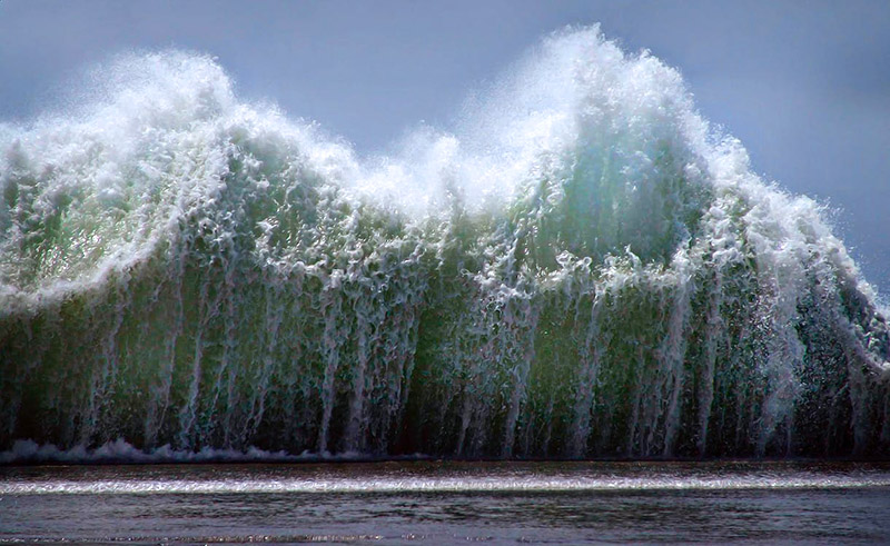
A tsunami is a large wave triggered by an earthquake, eruption, or underwater landslide. These underwater waves travel at approximately 500 MPH when at sea and 20-30 MPH at shore, and while only a few inches high at sea can result in waves of 10-50 feet or higher at shore, resulting in tremendous damage and loss of life. Mr. John Quigley of SAIC will present on the systems engineering associated when designing an early warning system for tsunamis.
(Photo by Ray Bilcliff on Pexels.com)
Meeting Information
Date: Wednesday, 16 August 2023, 5:45-7pm Pacific Time (presentation begins at 6pm).
Location: Filippi’s Restaurant in Kearny Mesa (San Diego). 5353 Kearny Villa Rd, San Diego, CA 92123 (Google Maps)
Cost: Free! There is also an optional buffet serving Italian food (pizza, pasta, salad, etc.) and soft drinks. $5 for members, $15 non-members
Zoom Link: This presentation will also be webcast for remote viewers.
Join Zoom Meeting
https://incose-org.zoom.us/j/89059012913
Tel: 669-900-6833
Meeting ID: 890 5901 2913
Synopsis
Tsunamis are large waves triggered by earthquakes, eruptions, or underwater landslides. These underwater waves travel at approximately 500 MPH when at sea and 20-30 MPH at shore. Early detection of tsunamis helps public safety authorities direct coastal populations out of harm’s way, saving countless lives around the world from ocean waves that can as high as 100 feet.
Vigilance in monitoring conditions
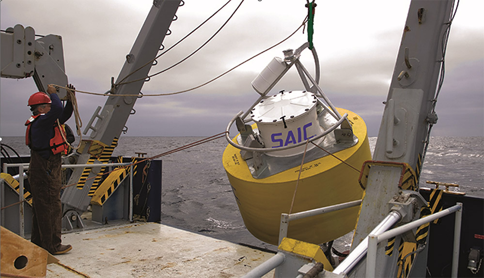
The countries use seawater temperature and pressure readings collected by our buoys for calculations of water height above the sea floor.
The buoys make measurements in near real time and typically transmit data reports via satellite every few hours; during tsunami events, the frequency of transmissions is higher. This vital information contributes to the estimation of impacts and planning of evacuations.
The buoys use tsunameter technology licensed from the National Oceanic and Atmospheric Administration (NOAA) and are enhanced versions of NOAA’s own buoys. In turn, the agency has acquired buoys from the Science Applications International Corporation (SAIC).
The buoys are also several generations mature, with more advanced components and greater robustness to reliably provide high-resolution measurements. SAIC continues to collaborate with NOAA in their ongoing development.
Important work to make the world safe
Around 85 percent of all commercially deployed buoys are from SAIC. At a 17,000-square-foot facility in Poway, California, the SAIC team builds these systems that must work in some of the globe’s roughest open waters.
The team members perform oceanographic reviews of potential buoy deployment sites, coordinate with NOAA, and monitor deployed systems. Some go out to sea for months at a time to deploy or recover systems that need reconditioning.
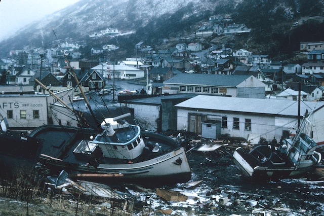
This work is a critical piece of larger scale efforts to prevent tragedies like the 2004 Indian Ocean tsunami that claimed almost 228,000 lives in 14 countries.
For almost 19 years, SAIC has been building deep-sea sensor buoys that continuously record and transmit oceanic measurements for use in forecasting and alerts. They have deployed over 45 observational buoy systems for nation-state customers that include Australia, Chile, China, India, Japan, Russia, Taiwan, and Thailand—vulnerable countries along the seismically active Pacific Rim.
Presenter: Mr. John Quigley

John Quigley is a Principle Systems Engineer at the Science Applications International Corporation (SAIC) in San Diego, California. During his extensive career, he has supported numerous technical programs in support of the U.S. Navy at the Naval Information Warfare Systems Command (NAVWAR) and the Naval Information Warfare Center Pacific (NIWC-Pacific). In addition to being a long-time member of INCOSE, John has served INCOSE and the San Diego chapter for over 10 years in roles such as chapter President and, more currently, as the principle chapter overseer of chapter activities for compilation and scoring in INCOSE’s yearly chapter awards program, directly resulting in the chapter achieving Best chapter in 2019 and the Platinum award for five consecutive years.
RSVP deadline is past